Projects
Enterprise GIS collaborates with other academic and administrative departments on projects that require or will benefit from GIS tools and applications. Projects recently completed or currently underway are listed below.
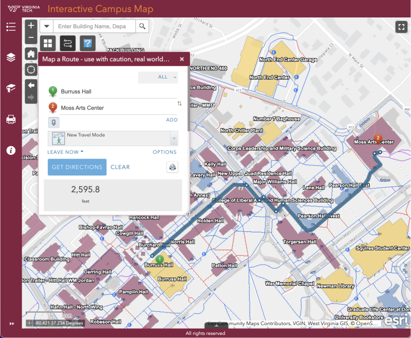
New interactive campus map and routing tool - Summer 2022
Enterprise GIS collaborated with Campus Planning, Infrastructure, and Facilities GIS (DCPIF GIS), University Relations, and the Office for Equity and Accessibility to update the interactive campus map. A new navigation too allows users to identify and follow accessible routes to and from buildings throughout campus. Additionally, the new map utilized the ESRI ArcGIS platform, allowing DCPIF GIS to update the map in virtual real tim.
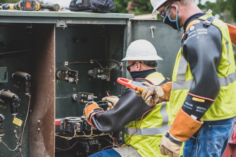
Mapping underground utilities using real-time telemetry
Enterprise GIS is working with DCPIF and the Virginia Tech Electric Service (VTES) to measure and map underground utilities on the Virginia Tech campus. With this project, Enterprise GIS has helped to set up specialized tools and software, including SCADA (supervisory control and data acquisition), which gathers and monitors data on the utility infrastructure, and PI Integrator, which makes this data available in ESRI's Geo Event Server software. Using this set up, VTES staff can view and monitor our utility infrastructure in real time, which aids in troubleshooting, maintenance, and repair.